
Trace Tullahoma Streets by Address
Address work in Tullahoma starts by deciding whether the parcel sits in Coffee or Franklin County. The incorporated city reaches into both counties, so a city mailing address alone does not choose the assessor, Register of Deeds, election office, or court counter. Start with the physical, or situs, address and verify the parcel before following a name through another index.
A street search can document assessed ownership, a transfer, a permit, or a known voter's registration. It cannot turn property filings into a household list. The best route moves from the exact address to the parcel and legal description, then to the owner and deed parties. That sequence is more reliable when an older document uses a lot number, a road abbreviation, or a different postal label.
- Check the address with the appropriate county assessor. Save the parcel ID, situs address, owner name, mailing address, subdivision or lot, and transfer reference when shown.
- Use the county property map or assessor terminal to verify the parcel and its adjoining polygons. Coffee's direct GIS viewer controls were not available during research, so confirm map functions at the office.
- Search the current owner or grantee in the Register of Deeds. Read the legal description and source-of-title book and page before moving to an earlier instrument.
- Repeat the owner-to-deed step for each parcel along the street. A deed party or tax mailing address is recorded notice information, not proof that a person lives there.
- For a known person only, use Tennessee's voter lookup as a corroborating check. Historical address evidence may also appear in a reverse directory, but its local holdings need confirmation.
Note: Tullahoma's city label is not enough to select a county custodian for a street record.
Tullahoma Street Directory County Split
Coffee County is the main records hub for most Tullahoma addresses, while Franklin County handles the Franklin-side portion. The City Recorder may hold a municipal permit or open-records file at City Hall, even when land or election records belong at a county office. The city also issues permits for the other portion of Tullahoma in Franklin County, according to Coffee County's Census building-permit footnote. That administrative fact does not change the county that keeps a parcel's assessor and deed record.
For a disputed or unfamiliar address, compare the parcel county first. Coffee County Property Record Information links the public assessment route and describes public map information. On the Franklin side, the Franklin County Property Assessor documents its parcel-card fields and public-terminal option. The different access paths are a reason to keep the street address, county, and parcel identifier together in research notes.
Tullahoma Street Directory Assessor Routes
The Coffee assessor maintains tax rolls, ownership records, tax maps, taxpayer indexes, and assessments. Its official property page sends users to the statewide assessment application after an agreement screen. The research inspection could not reach Coffee's live fields because of a JavaScript and access boundary. The documented purpose supports asking for owner, address, or parcel information, but it does not support claiming a particular Coffee form label, filter, export, or result limit.
The conservative search choices below separate what the offices document from what still needs a live check. They keep an address-based Tullahoma street directory search anchored to a parcel instead of an assumed resident name.
| Search path | County route | What is documented | Important limit |
|---|---|---|---|
| Owner name | Coffee assessment route | Ownership and taxpayer-index responsibility | Live Coffee field label and matching rules were not inspected |
| Street or situs address | Coffee assessment route | Property-record and map access | Exact address format and result behavior are not confirmed |
| Parcel or map number | Coffee or Franklin assessor | Stable land identifier for tax-map and deed work | Use the relevant county, not the postal city alone |
| Property card | Franklin public terminal | Owner, address, parcel, mailing, values, and transfers | Card owner is not guaranteed to be the current occupant |
Visit the Tennessee assessment portal reached from Coffee's property page before relying on its availability. The captured view below shows that portal route, although the research could not inspect Coffee's active search controls.
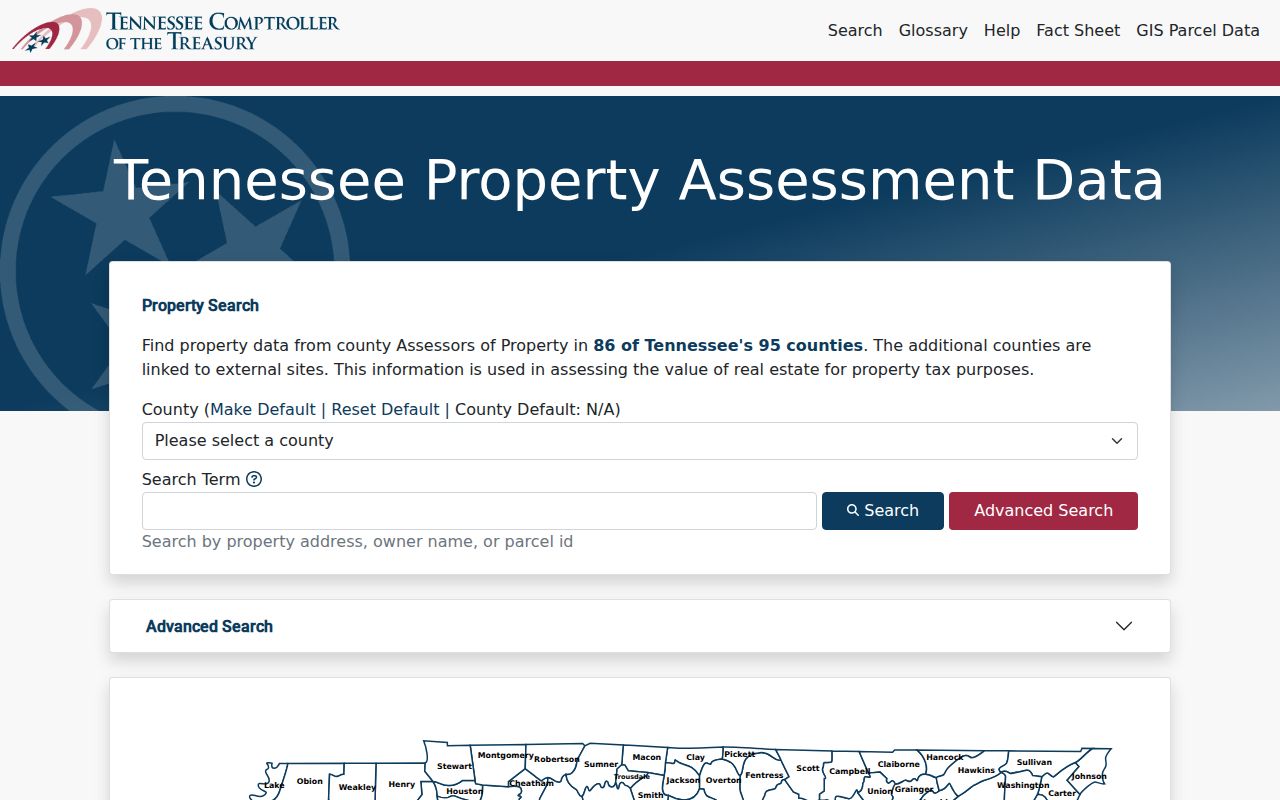
When the online route does not return a usable card, the Coffee Property Assessor counter is the fallback. The office maintains the roll and can confirm how a specific Tullahoma parcel should be searched.
Tullahoma Streets Through Parcel Cards
Franklin County offers the clearest public description of a property card for the portion of Tullahoma in that county. Its assessor says cards are updated weekly through the Tennessee Local Assessor System and that a public terminal is available. A card can include street address, owner names, parcel ID, owner mailing address, subdivision and lot, dimensions or acreage, construction components, improvement and land values, appraisal, classification, assessment, and transfer sale data with deed volume and page.
Those fields answer different questions. The situs places the land. The mailing address shows where tax notices go. A parcel ID and lot or legal description are the links that survive a changed street label. Sale amount and assessment value are also distinct figures. Treat the information as an ownership trail, then confirm a deed at the recorder before drawing conclusions about an address.
The Franklin assessor page explains the public-terminal fallback and its documented card fields.
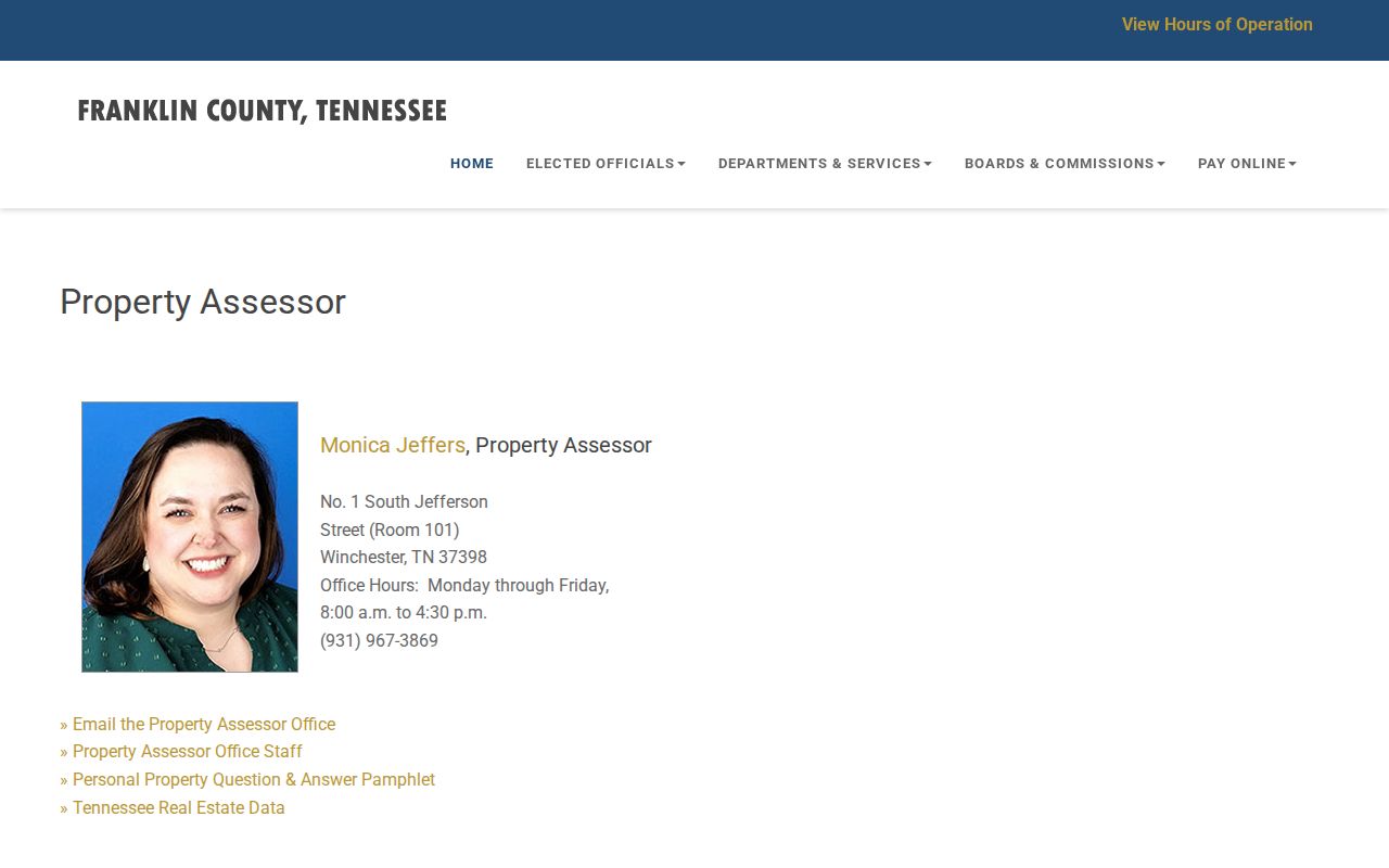
This Franklin-side example is a useful field model. Coffee cards may differ, so verify Coffee fields with that assessor rather than copying the Franklin format.
Tullahoma Street Permits and Code Cases
Tullahoma CitizenServe advertises permit applications, active-permit viewing, planning applications, inspections, payments, complaints, and request tracking. City Planning, Codes, and Life Safety is the custodian route for construction, alteration, inspection, and certificate records. A dated permit can help explain work on a parcel, while a code complaint can supply a case number and status path.
CitizenServe's public landing did not expose historical coverage years or result fields during research. The Code Enforcement process confirms that a property address and violation are used to open a complaint, staff assign a case number, inspect, notify the record owner, and provide status by phone. It does not establish that the requester, owner, contractor, or inspector lives at the property.
- Parcel
- A county land identifier that ties a mapped piece of land to the tax roll and often to deed references.
- Situs address
- The physical address of the parcel, which can differ from the owner's tax-roll mailing address.
- Plat
- A recorded map that can connect a subdivision lot or block to a street and nearby parcels.
- Criss-cross directory
- An older directory section arranged by address or street rather than alphabetically; the relevant Tullahoma runs need shelf confirmation.
Tullahoma Street Record Sources
Each address-keyed source answers a narrow question. Parcel and deed records are the core of a street-by-street trail. Permit and code files can add a municipal event. The election lookup confirms one known person, not an entire street. Use the table as a routing aid, then ask the custodian about access gaps instead of filling them with assumptions.
| Address record | Local keeper | Useful street detail | Access route |
|---|---|---|---|
| Tax roll and property card | Coffee or Franklin assessor | Assessed owner, parcel, situs, mailing address, value, and transfers where shown | Coffee assessment route or office; Franklin terminal |
| Parcel map | County property or GIS route | Mapped parcel, parcel ID, roads, and adjoining polygons | Coffee public-property link; direct viewer controls remain unverified |
| Recorded instrument | Register of Deeds | Parties, instrument date, legal description, source book and page | Coffee recorder or Franklin recorder/index |
| Permit or code file | Tullahoma Planning/Codes | Address, project or complaint, inspection, case number, and status route | CitizenServe landing or office follow-up |
| Voter confirmation | State lookup and county election office | Known registrant and absentee-status query | Five-field individual search, not a street export |
Parcel ID and legal description are the durable bridges across these sources. The street name is helpful, but it can be abbreviated, reused, or paired with a postal city that is not the parcel's municipal boundary.
Note: Coffee map information is public but periodically updated and carries no accuracy warranty.
Tullahoma Street Deed-Index Contrast
The Register of Deeds follows recorded instruments, not addresses as a general household index. Coffee records deeds, deeds of trust, mortgages, liens, plats, leases, judgments, powers of attorney, wills, court orders, military discharges, and UCC instruments. Its recording requirements identify the clue set that can connect a parcel to an earlier document: grantee and tax-bill addresses, map or parcel number, legal description, source book and page, signatures, notary data, and consideration or debt information.
Franklin's Register of Deeds FAQ gives a more precise online picture. Documents recorded after July 1998 are viewable online; older material is being scanned and indexed back to an 1883 deed book and a 1965 trust book, with work toward 1807. The online index is name-based, and Franklin directs address searchers to the assessor. Coffee's exact online start year and public field order were not located, so call its recorder before assuming a missing online hit means a missing deed.
This is a useful local comparison: Franklin publishes its online coverage, while Coffee's cutoff remains a call-ahead question. In either county, work from the parcel to the current owner, then from the deed's seller and source title to the preceding instrument.
Tullahoma Street Voter Check Limits
Tennessee Voter Registration Lookup is designed to confirm an individual registration. It requires county, first name, last name, birth month, and birth year, then returns voter or absentee information or a no-record message. A Tullahoma address may need a Coffee or Franklin county choice, so trying the wrong county can create a false no-record result.
The lookup does not enumerate every person on a street. Coffee's published material does not provide a public bulk-file form, fee, format, or permitted-use policy, and the state declaration excludes Social Security, driver-license, and Department of Safety or Homeland Security ID numbers. For street work, parcel records come first; use an individual voter query only as a careful check of a known person.
Tullahoma Street Postal Labels
Postal geography can add another layer of confusion to a street directory search. USPS identifies 37388 as the primary Tullahoma city mailing area, while 37389 is associated with Arnold Air Force Base or a unique-facility mailing context. Historical USPS scheme tables grouped 37360, 37388, and 37389 for Tullahoma mail processing. That grouping describes sorting, not an incorporated-city parcel map.
Use the USPS ZIP lookup to standardize delivery information, then use the county assessor and parcel records to identify the land. A ZIP result is not proof that a person occupies an address. The 2026 Wilson Avenue traffic-pattern notice is another reminder that an intersection description may change while a parcel's legal description remains the stronger continuity key.
Tullahoma Street Privacy Boundaries
A public street record can leave important facts unlisted. Property records do not reliably show every household member, utility customer, mail recipient, or current occupant. Motor-vehicle data is restricted under the Driver's Privacy Protection Act. Protected voters and Tennessee Safe at Home participants also should not be reverse-located, and sealed court, vital, adoption, juvenile, and victim records are not ordinary address leads.
Use an owner mailing address only as the notice address recorded by the custodian. Do not turn it into a claim about a person's present residence. If a record is absent, the right answer may be that it is protected, outside the county, or never created in a public address index. For older household evidence, the historical collections belong in the Tullahoma City Directory rather than a claim based on a modern parcel card.
Lawful use. Tullahoma address records support personal, lawful research and civic questions. Do not use them to stalk, harass, intimidate, or harm any person.
Note: Safe at Home supplies a substitute address to eligible participants and does not erase every older public record.